3D laser scanner measurement system
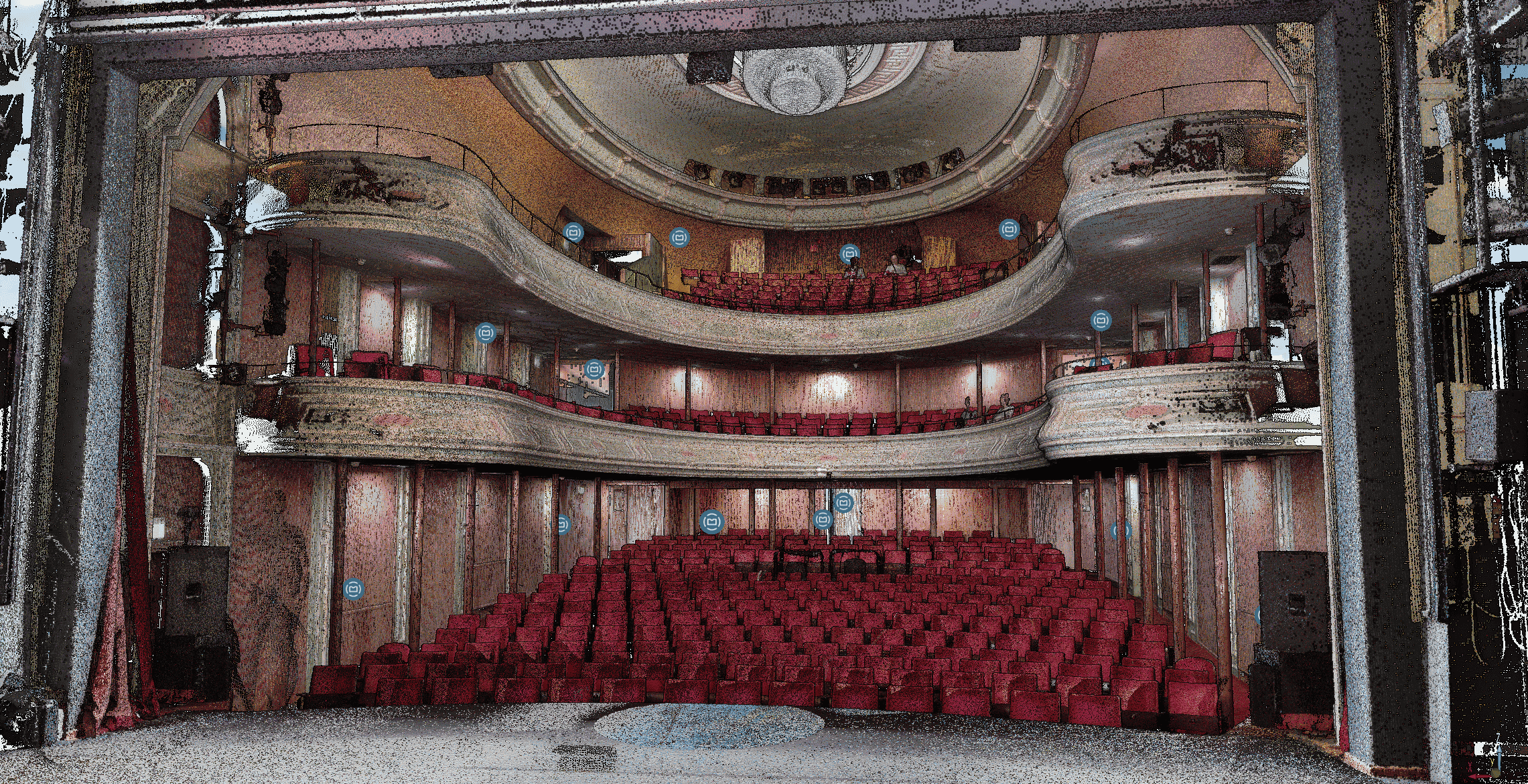
3D measuring with a laser scanner is a high-quality technique that allows objects and environments to be measured accurately and completely. It works on the basis of laser scanners that generate a 3D model of an object or a space using a scanning process. These laser scanners use laser beams to measure points in space, with accuracy down to millimeter level. Laser scanning is often used in construction projects because of the many benefits it offers. It provides a direct and detailed representation of the object or environment, without the need for physical contact. Using the latest laser scanning technologies, complex objects and structures can be measured with high accuracy. This provides new possibilities for designing, planning and managing projects.
After we have completed the intake with you and identified your question, an accurate scan plan will be drawn up for laser scanning. Together with the result you ultimately want, this forms the basis for a quotation. After approval, those involved at the customer are informed in advance about the work and safety plays a leading role in project preparation. All our employees are therefore fully VCA certified. Depending on the customer and location, additional safety training is also followed.
Endless possibilities wit a laser scanner measurement system
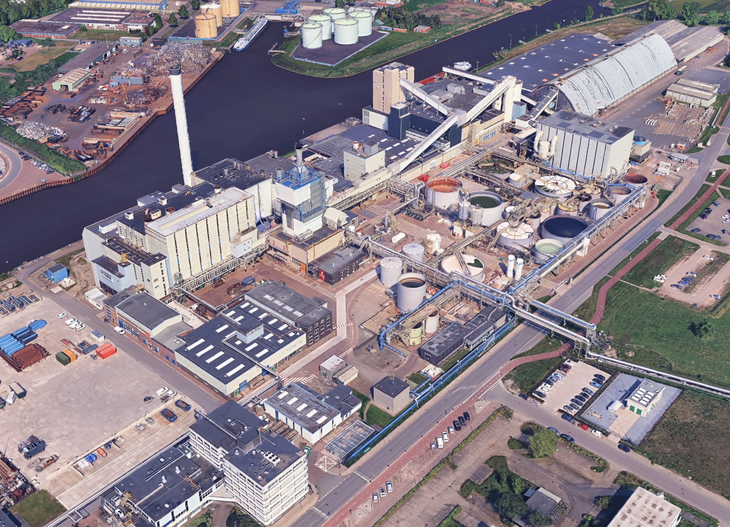
The use of 3D measuring with a laser scanner offers many possibilities in various projects. Construction projects benefit from the detailed and accurate measurements that laser scanning provides. It enables architects, engineers and contractors to gain a good understanding of the existing situation and thus create effective designs and plans. The 3D model that is created can be used for visualization, analysis and simulation, resulting in better decision-making and more efficient project execution.
We coordinate the execution on location in such a way that work can continue as normal in your company as much as possible during the scanning. Our scanners are ‘laser class 1’ and are harmless to the eyes. Depending on the type of project, a reference grid is plotted with points (point cloud) or linked based on overlap of the scans. The scan positions from the scan plan are filled in, requiring at least a few minutes per position. The scans of buildings or objects are then processed into a linked point cloud model ( more about a point cloud here ) Based on your wishes can be translated into a 2D or 3D drawing with the correct dimensions or other relevant information of installations in, for example, industry. Make an appointment now to see a demo.